Paul's journeys
The four journeys of Acts, from Antioch to Rome
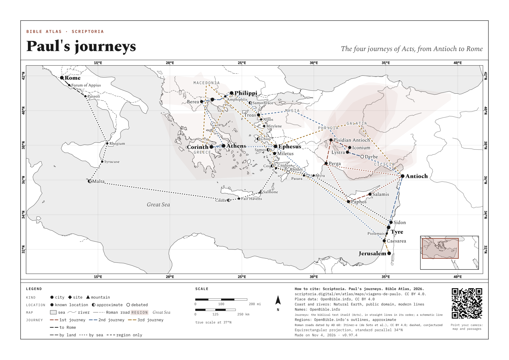
In the order Acts tells them, with each stop's verse. Only the places the text names; no stop that tradition added.
On the map, the arrow keys move it, + and − zoom in and out, and 0 goes back to the full view. Every place is a link.
BY LAND BY SEA WIDER DASHES: THE TEXT NAMES ONLY THE REGION SCHEMATIC: STRAIGHT LINES BETWEEN THE STOPS, IN THE TEXT'S ORDER; THE REAL WAY WAS LONGER WASH: A REGION'S APPROXIMATE BOUNDS, STRONGER WHERE MORE SOURCES AGREE ROMAN ROAD DATED BY AD 60 (ITINER-E, CC BY 4.0) · DASHED: CONJECTURED COURSE
The first journey
ACTS 13:1-14:28 · c. AD 46-48
About 1,200 mi (2,000 km) adding up the map's straight lines. The farthest point was Pisidian Antioch, about 310 mi (500 km) from Antioch as the crow flies.
- 1 Antioch START 13:1-3
- 2 Seleucia BY LAND 13:4
- 3 Salamis BY SEA 13:5
- 4 Paphos BY LAND 13:6-12
- 5 Perga BY SEA 13:13
- 6 Pisidian Antioch BY LAND 13:14-50
- 7 Iconium BY LAND 13:51-14:5
- 8 Lystra BY LAND 14:6-19
- 9 Derbe BY LAND 14:20-21
- 10 Lystra BY LAND 14:21
- 11 Iconium BY LAND 14:21
- 12 Pisidian Antioch BY LAND 14:21-23
- 13 Perga BY LAND 14:25
- 14 Attalia BY LAND 14:25
- 15 Antioch BY SEA 14:26-28
The second journey
ACTS 15:36-18:22 · c. AD 49-52
About 2,200 mi (3,500 km) adding up the map's straight lines. The farthest point was Berea, about 810 mi (1,300 km) from Antioch as the crow flies.
- 1 Antioch START 15:36-40
- 2 Cilicia BY LAND · REGION ONLY 15:41
- 3 Derbe BY LAND 16:1
- 4 Lystra BY LAND 16:1-5
- 5 Phrygia BY LAND · REGION ONLY 16:6
- 6 Mysia BY LAND · REGION ONLY 16:7-8
- 7 Troas BY LAND 16:8-10
- 8 Samothrace BY SEA 16:11
- 9 Neapolis BY SEA 16:11
- 10 Philippi BY LAND 16:12-40
- 11 Amphipolis BY LAND 17:1
- 12 Apollonia BY LAND 17:1
- 13 Thessalonica BY LAND 17:1-9
- 14 Berea BY LAND 17:10-14
- 15 Athens BY SEA 17:15-34
- 16 Corinth BY LAND 18:1-17
- 17 Cenchreae BY LAND 18:18
- 18 Ephesus BY SEA 18:19-21
- 19 Caesarea BY SEA 18:22
- 20 Antioch BY LAND 18:22
The third journey
ACTS 18:23-21:17 · c. AD 52-57
About 2,500 mi (4,000 km) adding up the map's straight lines.
- 1 Antioch START 18:23
- 2 Galatia BY LAND · REGION ONLY 18:23
- 3 Phrygia BY LAND · REGION ONLY 18:23
- 4 Ephesus BY LAND 19:1-41
- 5 Macedonia BY LAND · REGION ONLY 20:1
- 6 Greece BY LAND · REGION ONLY 20:2-3
- 7 Philippi BY LAND 20:3-6
- 8 Troas BY SEA 20:6-12
- 9 Assos BY LAND 20:13-14
- 10 Mitylene BY SEA 20:14
- 11 Chios BY SEA · SAILED PAST 20:15
- 12 Samos BY SEA 20:15
- 13 Trogyllium BY SEA 20:15
- 14 Miletus BY SEA 20:15-38
- 15 Cos BY SEA 21:1
- 16 Rhodes BY SEA 21:1
- 17 Patara BY SEA 21:1-2
- 18 Tyre BY SEA 21:3-6
- 19 Ptolemais BY SEA 21:7
- 20 Caesarea BY LAND 21:8-14
- 21 Jerusalem BY LAND 21:15-17
The voyage to Rome
ACTS 27:1-28:31 · c. AD 59-62
About 1,900 mi (3,000 km) adding up the map's straight lines.
- 1 Caesarea START 27:1-2
- 2 Sidon BY SEA 27:3
- 3 Myra BY SEA 27:5-6
- 4 Cnidus BY SEA · SAILED PAST 27:7
- 5 Salmone BY SEA · SAILED PAST 27:7
- 6 Fair Havens BY SEA 27:8-13
- 7 Cauda BY SEA · SAILED PAST 27:16
- 8 Malta BY SEA 28:1-11
- 9 Syracuse BY SEA 28:12
- 10 Rhegium BY SEA 28:13
- 11 Puteoli BY SEA 28:13-14
- 12 Forum of Appius BY LAND 28:15
- 13 Three Taverns BY LAND 28:15
- 14 Rome BY LAND 28:16-31
PRINT OR DOWNLOAD
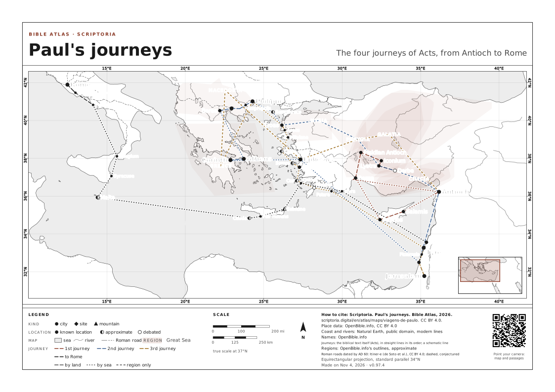
This map on an A4 or A3 sheet, with a frame, a legend, a scale and the source of every piece of data. Free for class and study: CC BY 4.0, crediting Scriptoria.
STOPS AND VERSES: FROM THE BIBLICAL TEXT ITSELF
← ALL THE MAPS