ATLAS
The places of the Bible
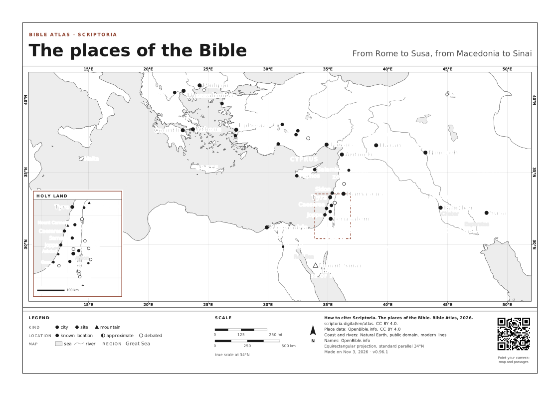
Each place with the passages that mention it and what happened there. It's the other half of the promise: reading by the map, not by the table of contents.
1342 places mapped
PLACES IN DEUTERONOMY 18 ← Back to the chapter
On the map, the arrow keys move it, + and − zoom in and out, and 0 goes back to the full view. Every place is a link.
WHAT THIS MAP SHOWS
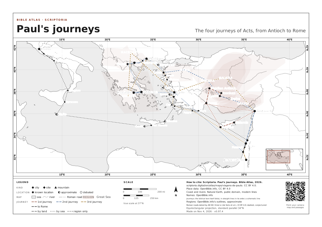
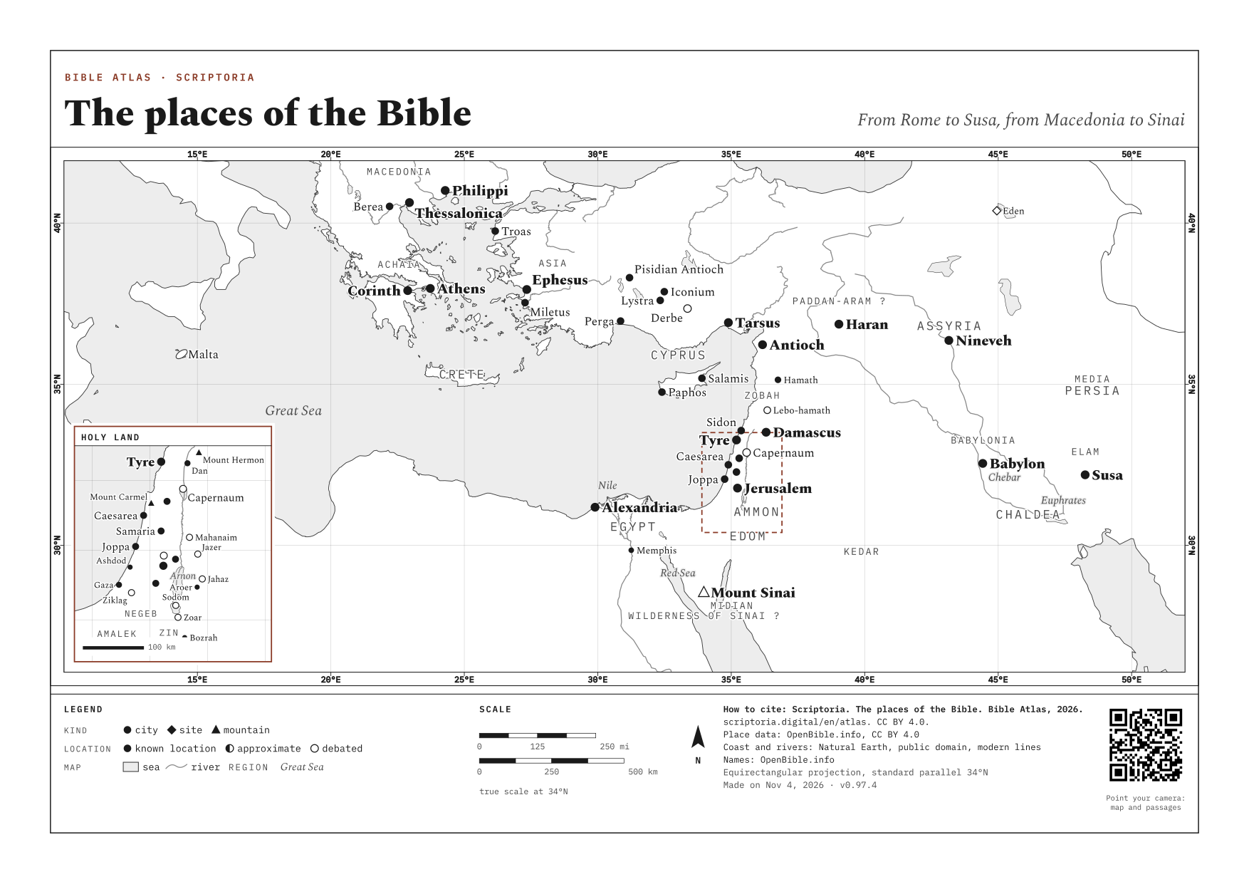
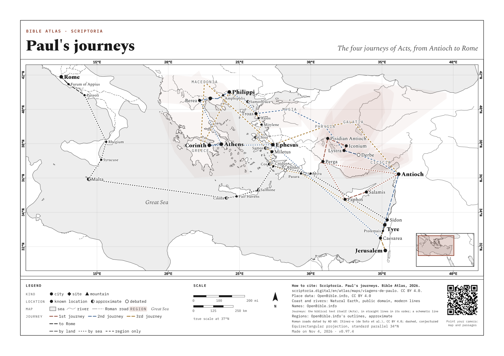
Places dated c. AD 30-62, drawn over today's coastline. Over two thousand years, harbors silted up and deltas shifted: Ephesus and Miletus were ports and now lie miles inland. The cities' positions are surveyed; the coastline is approximate.
REFERENCE MAPS
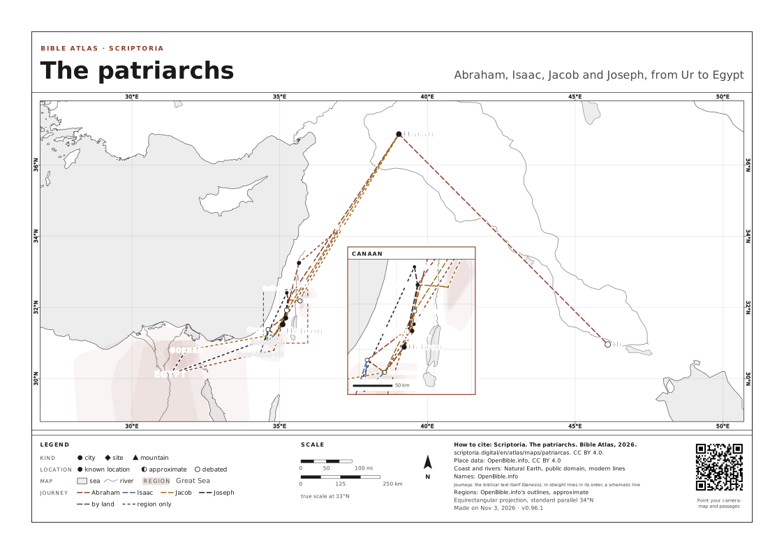
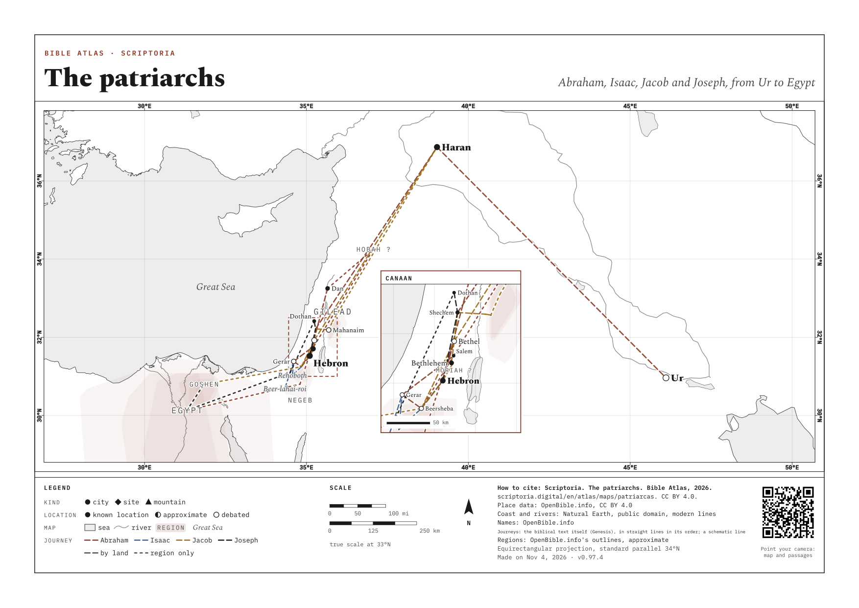
ALL →- The patriarchs Abraham, Isaac, Jacob and Joseph, from Ur to Egypt
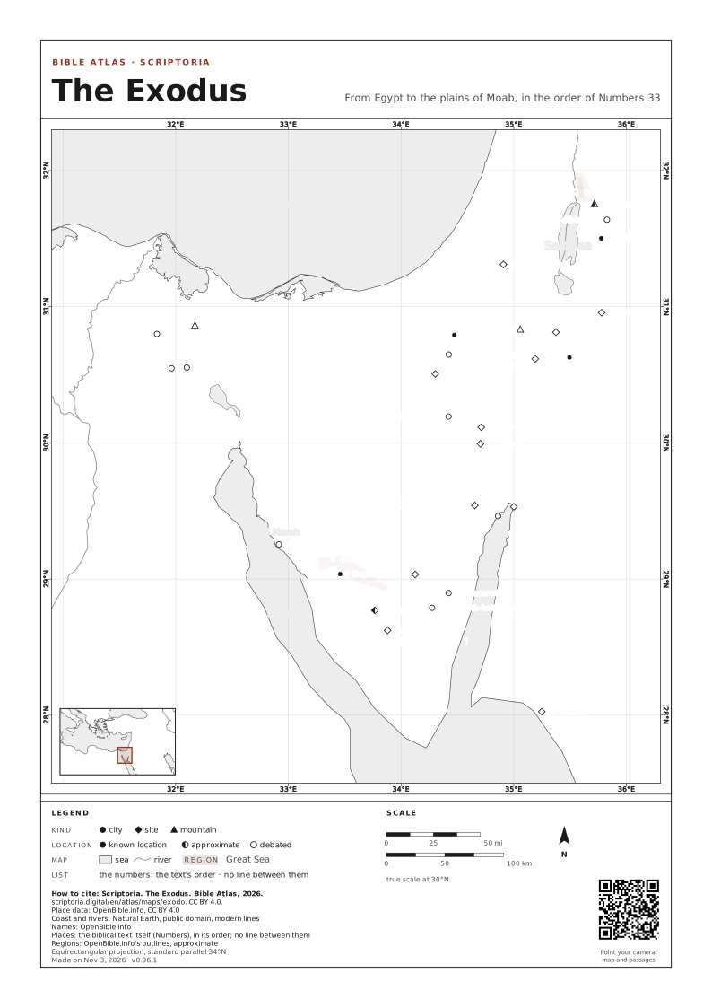
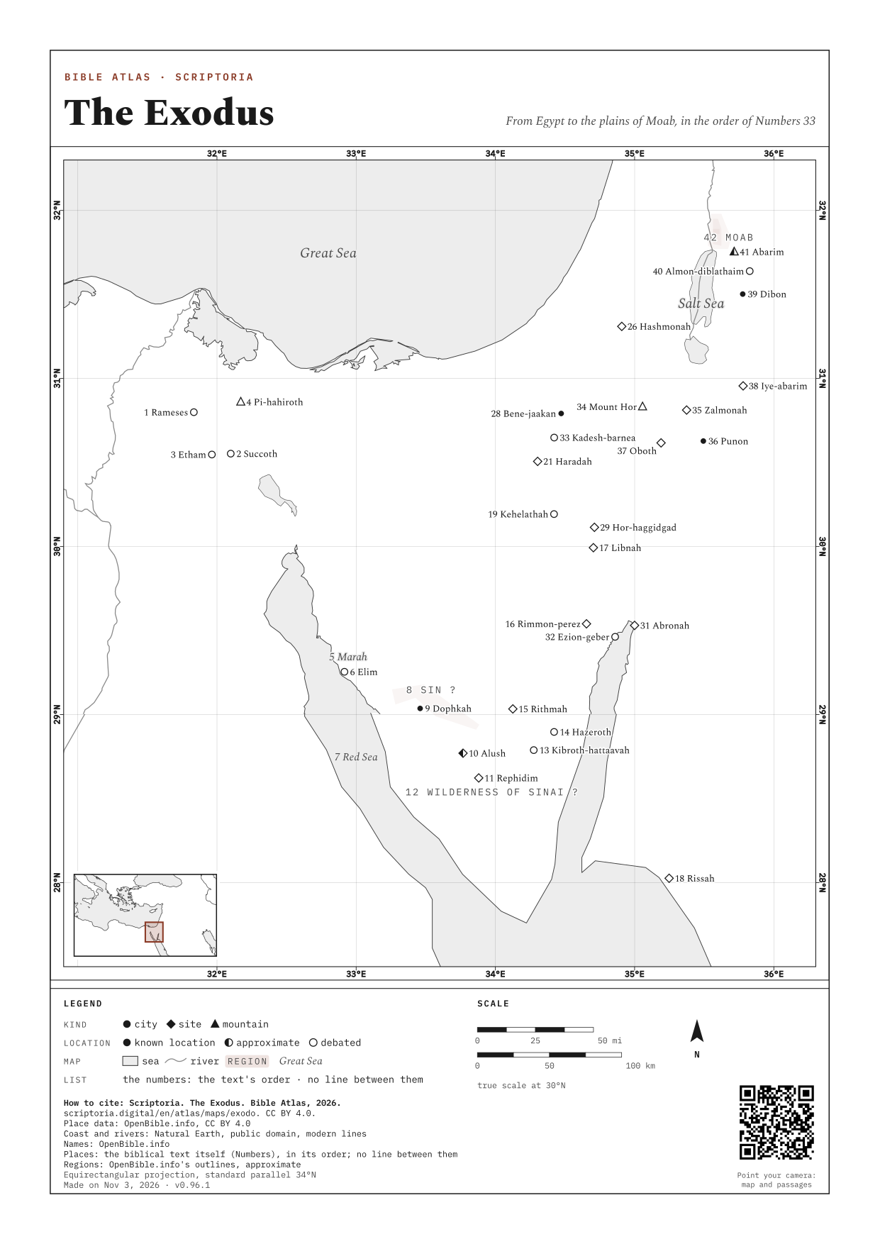
- The Exodus From Egypt to the plains of Moab, in the order of Numbers 33
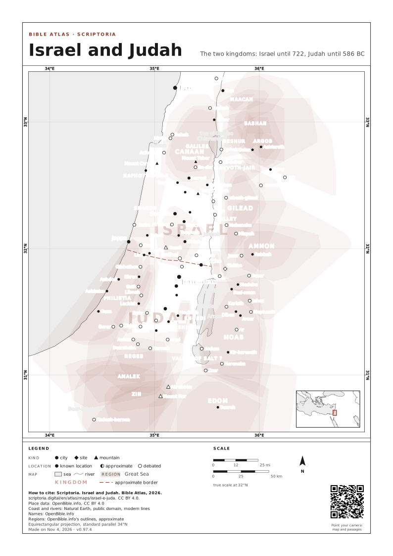
- Israel and Judah The two kingdoms: Israel until 722, Judah until 586 BC
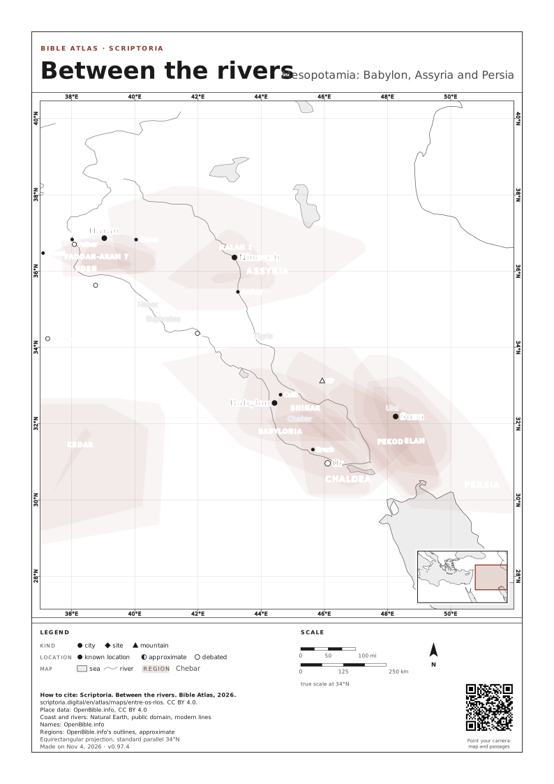
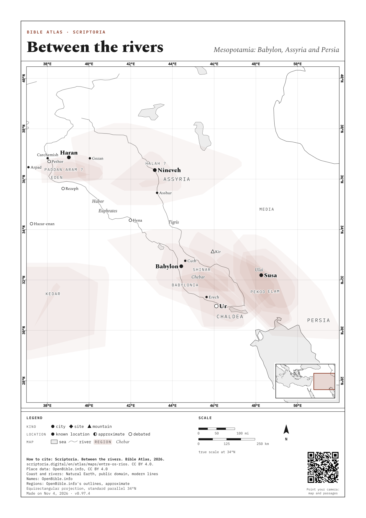
- Between the rivers Mesopotamia: Babylon, Assyria and Persia
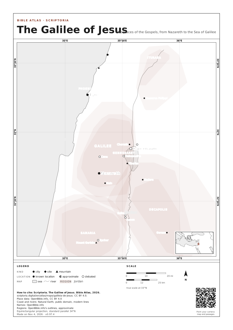
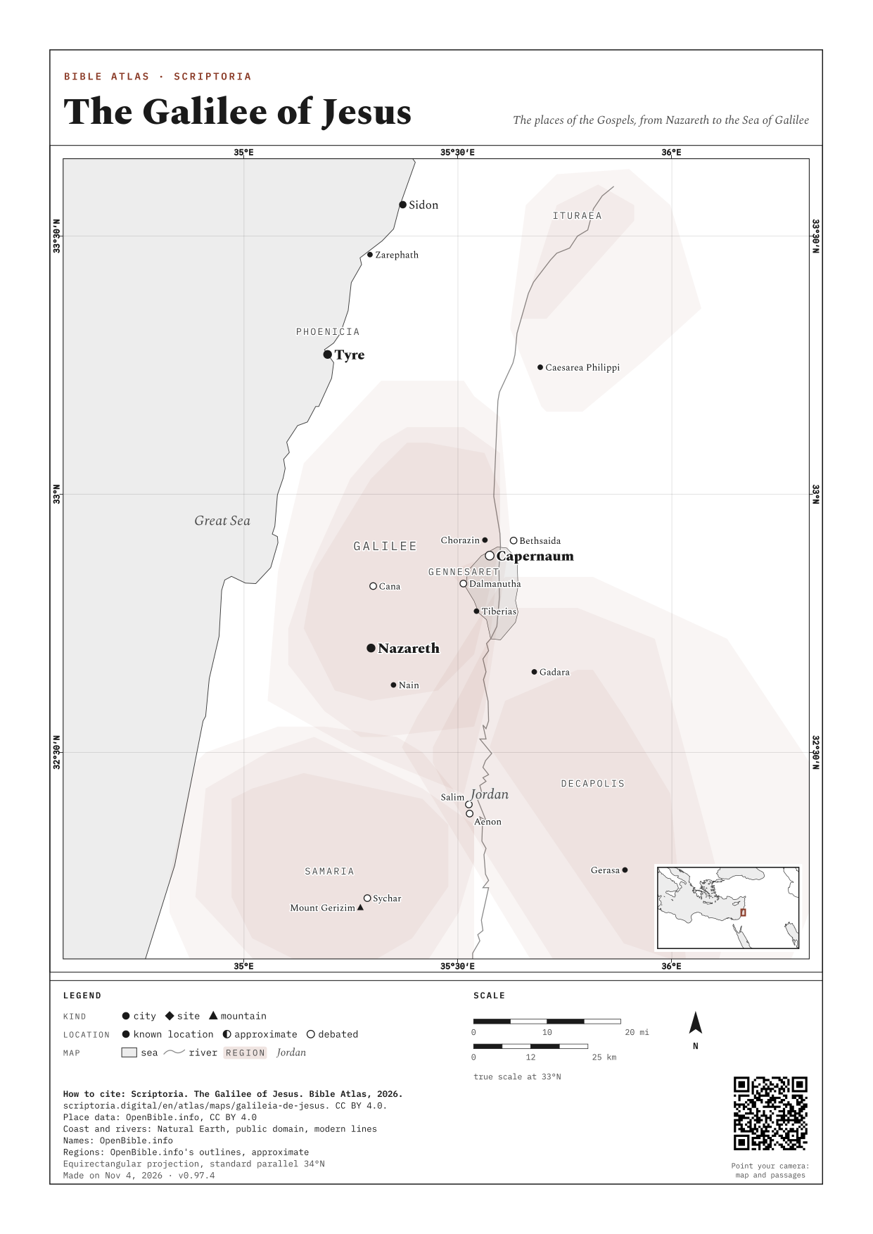
- The Galilee of Jesus The places of the Gospels, from Nazareth to the Sea of Galilee
- Paul's journeys The four journeys of Acts, from Antioch to Rome
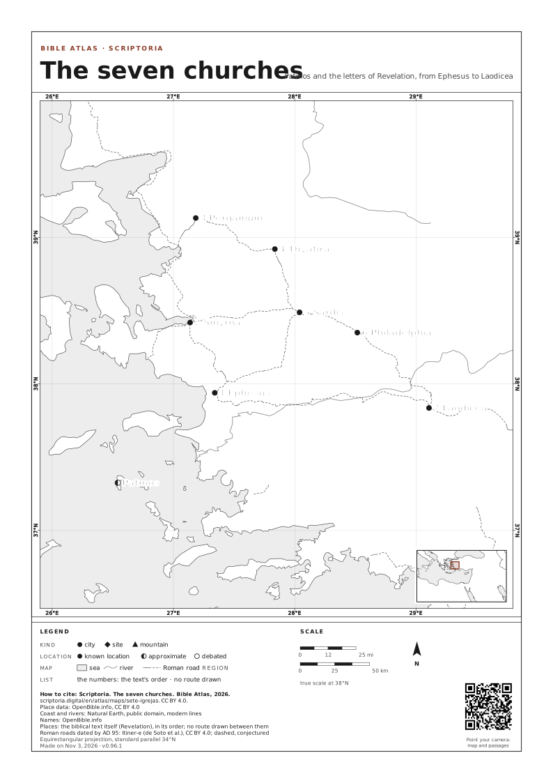
- The seven churches Patmos and the letters of Revelation, from Ephesus to Laodicea
BY BOOK 47 BOOKS
OLD TESTAMENT
1342 PLACES · page 1 of 23
- Abana 1 passage
- Abarim 4 passages
- Abdon 2 passages
- Abel-beth-maacah 5 passages
- Abel-keramim 1 passage
- Abel-meholah 3 passages
- Abel-mizraim 1 passage
- Abel-shittim 1 passage
- Abiezer 1 passage
- Abila 0 passages
- Abila Lysaniou 0 passages
- Abilene 1 passage
- Abronah 1 passage
- Accad 1 passage
- Acco 1 passage
- Achaia 9 passages
- Achshaph 3 passages
- Achzib 1 2 passages
- Achzib 2 2 passages
- Adadah 1 passage
- Adam 1 passage
- Adamah 1 passage
- Adami-nekeb 1 passage
- Adasa 0 passages
- Addar 1 passage
- Addon 2 passages
- Adithaim 1 passage
- Admah 5 passages
- Adoraim 1 passage
- Adramyttium 1 passage
- Adriatic Sea 1 passage
- Adulis 0 passages
- Adullam 9 passages
- Adummim 2 passages
- Aenon 1 passage
- Ahava 3 passages
- Ahlab 1 passage
- Ai 1 14 passages
- Ai 2 1 passage
- Ai 3 2 passages
- Aiath 1 passage
- Aija 1 passage
- Aijalon 1 8 passages
- Aijalon 2 1 passage
- Ain 1 1 passage
- Ain 2 3 passages
- Ain 3 1 passage
- Akeldama 2 passages
- Akrabbim 3 passages
- Alemeth 1 passage
- Alexandria Egypt · today Alexandria 5 passages
- Allammelech 1 passage
- Allon 1 passage
- Allon-bacuth 1 passage
- Almon 1 passage
- Almon-diblathaim 1 passage
- Alush 1 passage
- Ama 0 passages
- Amad 1 passage
- Amalek 23 passages
MAPS TO PRINT AND DOWNLOAD
The map on an A4 or A3 sheet, with its frame, legend, scale and the source of every piece of data. Free for class and study: CC BY 4.0, crediting Scriptoria.